
Contact for the resource
CSIRO Marine Remote Sensing
3 record(s)
Type of resources
Topics
Keywords
Contact for the resource
Provided by
Formats
Update frequencies
Status
draft
-
Sentinel-3 OLCI reduced resolution (approximately 1000m-pixel size) daily reprojected Level 2P above-water spectral remote sensing reflectance produced by CSIRO under eReefs Phase 5 using the FUB-CSIRO Coastal Water Processor (detailed description at https://doi.org/10.1016/j.rse.2021.112848). This product was derived from Level 2 geophysical quantities, and placed onto a regular grid using nearest neighbor resampling. Standard Level 1 quality flags have been applied to pre-mask and quality control the data (see file_version_quality_control). Additional algorithm input and output out-of-range flags (in_out_OR_combined_flags) are provided to further quality control the data. These flags have not been applied to pre-mask the data.
-
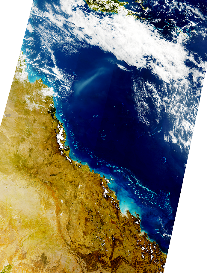
Sentinel-3 OLCI reduced resolution (approximately 1000m-pixel size) daily Level 1B true-colour quicklooks produced by CSIRO under eReefs Phase 5 delivered in GeoTIFF format.
-
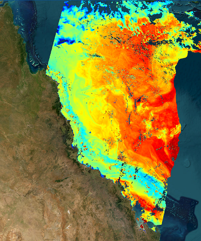
Sentinel-3 OLCI full resolution (approximately 300m-pixel size) daily reprojected Level 2P water quality (Chl-a, CDOM, TSS) produced by CSIRO under eReefs Phase 5 using the FUB-CSIRO Coastal Water Processor (detailed description at https://doi.org/10.1016/j.rse.2021.112848). This product was derived from Level 2 geophysical quantities, and placed onto a regular grid using nearest neighbor resampling. Standard Level 1 quality flags have been applied to pre-mask and quality control the data (see file_version_quality_control). Additional algorithm input and output out-of-range flags (in_out_OR_combined_flags) are provided to further quality control the data. These flags have not been applied to pre-mask the data.